Mulhacén (3479 m) is the highest peak in the Iberian Peninsula, located in Sierra Nevada National Park. There are a few trails leading to the summit. Some of them are easy but I chose the harder one – from Trevélez village. I almost succeeded ;)
It was my first hiking trip above 3000 m. Actually, also the first above 2500 m ;) Although high altitude, the mountain is however technically easy. You don’t need any climbing skills to get there. In summer, you also don’t need to be prepare for snow. You even don’t need to have good condition, if you choose a short trail.
How to get to Mulhacén?
- From village Capileira (from south) – as I know, this is the most popular trail. There is a bus from Capileira to Mirador de Trevélez, which is at about 2700 m. From this point you can easy get to Mulhacén summit and return to Capileira the same day with no rush. However, I’ve read that this bus runs only in season. I was in Sierra Nevada in October and I didn’t manage to find in internet informaton if it still works in this month. If you have a car, you can start a trip at about 2200 m at Hoya del Portillo. Without a car and a bus, getting to the summit from Capileira would be too difficult in one day.
- From Pradollano (from west) – another option, if you want to make a short hike, is to take a bus from Pradollano to Posiciones del Veleta, which is about 3000 m. This bus probably operates also only in high season but I don’t know details.
- From village Trevélez (from east) – the village is located at about 1500 m. There is no bus to take you higher. You can make two-day hike, staying in the mountain hut Refugio del Poqueira or – if you have good condition – get to the summit and return in one day.
- From Güéjar-Sierra (from north) – a really long and demanding trail. I think it can be done in one day only by a few people. Actually it would require running. If you want to get to the peak from this site, you can spend a night in free unstaffed shelter Refugio de la Cucaracha.
My trip to Mulhacén from Trevélez
My ambitious plan was to climb Mulhacén in one day, staying in village Trevélez. Below you can see my route:
It was October, the day was only 11,5 hours so I went out before 8 am, during twilight. The sun was already rising up, when I was leaving Trevélez.

On the beginning the trail is quite well marked. It leads on narrow path between or even through pastures. Few times I came across a gate with a board asking you to close the door after passing.

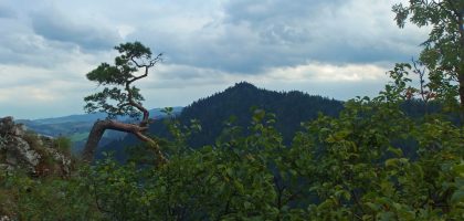
The whole trail leads on open area. There isn’t any forest in this region. On lower altitude there are only small bushes and few trees, and higher only stones. If you like vegetation you can be disappointed but if you prefer wide open landscapes, like me, you would be impressed.

I was surprised how little tourists were on this trail. During whole day I met them only four or so. I was alone in huge empty mountains and I met more animals than people. Cows, a horse, spanish ibexes and some birds of prey. This one was flying really low above me. My camera has only 5x zoom and this photo I made using 4x or so zoom.

Beside peace and possibility to see wild animals, walking alone outside high season has one more advantage. If you need a toilet you don’t have to look for some place to hide ;)
It was important for me, because remembering my altitude sickness on Rysy in Poland, which is only 2500 m, I tried to avoid such problems this time. I read somewhere in internet that it’s good to drink much water to avoid symptoms of altitude sickness, so I took much water ;) In fact, I think it really helped me. Only during descending, when I stopped to drink so much but I was still above 3000 m, I started to have light headache. It was much lighter than on Rysy and I didn’t have nausea nor other symptoms. Probably also a little longer time to acclimatize was helpful. Before ascending Rysy, I spent a night at about 1100 m and I was there only 9 hours. Here, I spent about 18 hours at altitude 1500 m.
Maybe a symptom of altitude sickness was my weakness at high altitude but I’m not sure to what extent it was because of altitude and to what extent because of my condition.
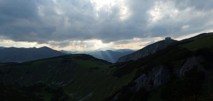
I tried to be pretty fast because from early hours I was seeing clouds coming to my direction. I didn’t want to walk in them. I tried to be above their altitude when they come.
It was 1 pm when I got to Siete Lagunas at about 2900 m. In English it’s Seven Lakes but I counted only three. The rest were dried.

The route requires taking food and drink for a whole day as there aren’t any staffed mountain huts. In Siete Lagunas there are only emergency shelters like this:

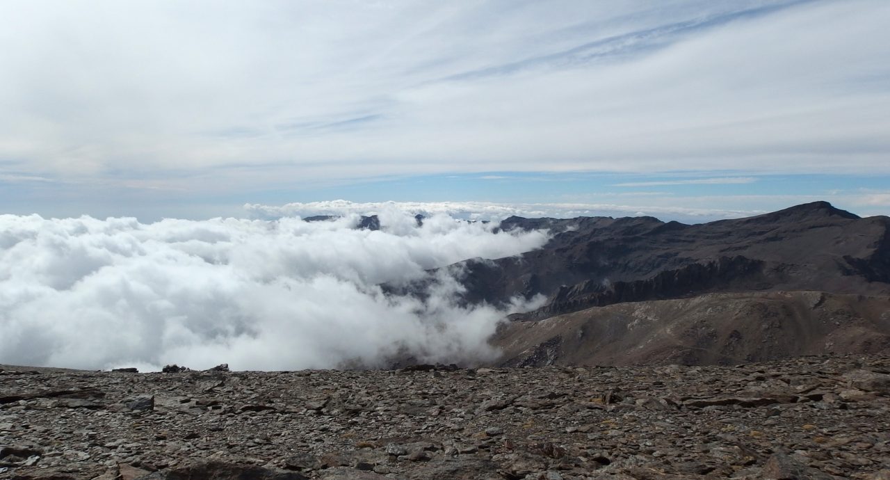
It was 2 pm when the clouds came. Fortunately I’ve been already higher than them so I had dreamed breathtaking views on clouds below me. I love such views!

Bad news was that I was planning to come to the summit no later than 2 pm… Before my trip to Spain I had problems with my knee. Now, during ascending it held well but I was afraid of pain during descending, which would slow me down. I didn’t want to return at night, being alone in mountains which I don’t know.
I had two possibilities: to climb Mulhacén and return the same way or bypass Mulhacén peak, walk to the lower summit of this mountain (Mulhacén II, 3360 m) and return the other, longer trail, as I have planned. I chose the second option.
I was happy I was above the clouds not only because of great views but also because of poor marking of trail. The aren’t any signs, only big stones or low towers of small stones. Although good visibility, few times I realised I was walking outside the trail. In clouds or in winter, when snow covers stones it can be really easy to get lost there.
At 3:30 pm I came to Mulhacén II. It was late and cold (about 10°C and strong wind) so I made few photos and went further.

Still between two layers of clouds, I was trying to walk down as fast as possible, but I couldn’t resist stopping from time to time to make photos. I won’t show you all of them to not bore you, I chose only the best :)
This is one of my favourites. Cumulus clouds just below me, one of them flying very close and blue sky with cirrus clouds above me. Just perfect!

Of course it wasn’t so nice, when I descended and was walking in the clouds ;) In one place, close to Alto del Chorrillo, I had serious dilemma where to go because I knew I had to turn left somewhere but in the clouds I couldn’t see the path.
And I mentioned ibexes :) I saw many of them this day, 20 or so, but most of them were far away. This is the best photo I managed to make them.

I saw only females. I didn’t come across any males with these thick big horns. Females of spanish ibex are similiar to tatra chamoises. But unless tatra chamoises, they are very shy and don’t let to approach closer than about 50 metres. In Tatra National Park, in Poland and Slovakia, it’s easy to approach to even few metres to chamoises. I was even in situations when I was afraid of them, because they were standing on a path or approaching me ;) This difference in behaviour I think it’s because in Tatra Mountains chamoises are safe. They are of course wild animals, they don’t let you touch them, but they hold distance of only few metres because they know tourists don’t harm them. In Sierra Nevada however, people hunt ibexes. You can find in internet many photos of happy people with dead ibex. It’s incomprehensible for me that it’s allowed because it’s also national park.
Fortunately any hunter killed me by accident, I didn’t lost and my knees kept well, and after 12,5 hours of walking without any long break, I returned to Trevélez :)


![]()
 Thank you :)


Justin Time
How much longer from Mulhacen II would it have taken to get to Mulhacen peak?
I ask because I am planning to do this in 1 day without a car – though in summer when there is more daylight – I estimate from around 6am- 9pm (15hrs).
maja
It’s not far, I think 30 – 60 min.
edith Van Rooy
Nice.
Did you manage to do it in one day? Would like to know because p’an it end of August to do it in one day.
Thanks
Edith
maja
I didn’t manage but I was close and I would have done it if the day was 1 hour longer (I didn’t want to hike at night). It’s possible to do in one day if you are in good condition.